


ST. ANSGAR TWP Voting District, Mitchell County, Iowa
About
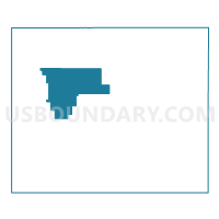
Outline

Summary
| Unique Area Identifier | 582849 |
| Name | ST. ANSGAR TWP Voting District |
| County | Mitchell County |
| State | Iowa |
| Area (square miles) | 28.60 |
| Land Area (square miles) | 28.55 |
| Water Area (square miles) | 0.04 |
| % of Land Area | 99.85 |
| % of Water Area | 0.15 |
| Latitude of the Internal Point | 43.38846920 |
| Longtitude of the Internal Point | -92.88111360 |
Maps


Graphs
Select a template below for downloading or customizing gragh for ST. ANSGAR TWP Voting District, Mitchell County, Iowa


Neighbors
Neighoring Voting District (by Name) Neighboring Voting District on the Map
- LIBERTY TWP & STACYVILLE TWP W/O STACYVILLE Voting District, Mitchell County, IA
- MITCHELL TWP Voting District, Mitchell County, IA
- NEWBURG TWP Voting District, Mitchell County, IA
- OTRANTO TWP Voting District, Mitchell County, IA
- ROCK TWP Voting District, Mitchell County, IA
- UNION TWP Voting District, Mitchell County, IA
Top 10 Neighboring County Subdivision (by Population) Neighboring County Subdivision on the Map
- St. Ansgar township, Mitchell County, IA (1,393)
- Stacyville township, Mitchell County, IA (756)
- Newburg township, Mitchell County, IA (408)
- Mitchell township, Mitchell County, IA (363)
- Otranto township, Mitchell County, IA (338)
- Rock township, Mitchell County, IA (304)
- Union township, Mitchell County, IA (255)
- Liberty township, Mitchell County, IA (231)